BLOG

sea level

Lost Ice-Sheet Porosity and Sea-Level Buffering

Posted by William Colgan on March 12, 2019
New Research, Sea Level Rise / Comments Off on Lost Ice-Sheet Porosity and Sea-Level Buffering

We have a new open-access study that investigates the high-elevation firn plateau of the Greenland Ice Sheet in the current issue of The Cryosphere1. Firn is the relatively low density near-surface ice-sheet layer comprised of snow being compressed into ice. Firn is relatively porous, meaning that meltwater can percolate through it. The refreezing of meltwater within firn is a potential buffer against the ice-sheet sea-level contribution from surface melt; surface melt can refreeze within porous firn instead of running off into the ocean. Our study aims to assess how big this sea-level buffer might be, and how much sea-level buffer may have already been used.

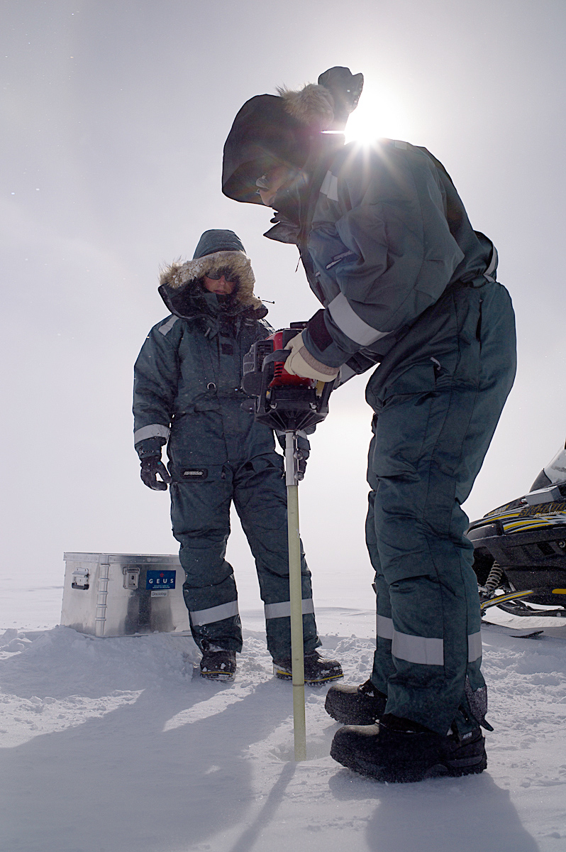
We pull together a singularly unique dataset – 340 ice-core measurements of firn density collected over 65 years – to assess the near-surface density across the entire high-elevation firn plateau of the Greenland Ice Sheet. Many of these vertical firn density profiles were digitized and brought together for the first time from historical studies, but twenty are collected by our team and new to science. We analyze this ice-core dataset for empirical relations between firn density and accumulation or air temperature. This allows us to divide the ice sheet into three distinct firn areas, within each of which we can confidently predict the vertical profile of near-surface firn density.

Figure 1 – Left: Firn air content within the top 10 m (FAC10) estimated from ice-core measurements (denoted with ‘x’). The ice sheet is divided into three areas: the Dry Snow Area (DSA), the Low Accumulation Percolation Area (LAPA), and the High Accumulation Percolation Area (HAPA). Right: Change in top 10 m firn air content between 1998–2008 and 2010–2017 within Low Accumulation Percolation Area along the ice sheet’s western flank.

We find that the firn structure at the heart of the ice sheet – the highest, coldest and driest firn known as the Dry Snow Area – appears to have been stable since 1953. There is no trend in firn density within the Dry Snow Area. At lower elevations, however, we find significant changes in response to recent increases in surface melt due to climate change. The area we call the Low Accumulation Percolation Area – an elevation band of relatively low snowfall and high melt along the ice sheet’s west flank – has a marked increase in the firn densities measured pre- and post-2009. This firn density change is equivalent to a sea-level buffer loss of 1.5±1.2 mm sea-level equivalent (540±440 gigatonnes).

We compare the ice-sheet-wide firn density structure that we estimate from ice-core measurements with the firn density structure estimated from three regional climate models. The regional climate models suggest that the decrease in firn porosity initiated in the early 2000s and accelerated with post-2010 climate change. But we also find non-trivial differences between the firn porosities simulated by regional climate models, and that inferred from ice-core measurements, especially in what we call the High Accumulation Percolation Area. Here – the ice sheet’s low elevation southeast flank – modeled firn porosity can be biased the equivalent of between 3 and 7 meters of air distributed over the entire firn column depth.

Figure 2 – Left: Ice-sheet-wide firn air content within the top 10 m of firn (FAC10) simulated by three regional climate models (MAR, HIRHAM and RACMO) and derived from ice-core observations (this study) in different ice-sheet areas. Right: Same for firn air content over the entire depth of the firn column (FACtot).

This study highlights the importance of bringing together firn density measurements to document the response of ice-sheet firn – a non-trivial component of the sea-level budget – to recent climate change. The ice-sheet-wide firn porosity structure we infer from ice-core measurements can also serve as an independent evaluation target for the firn porosity structures simulated by regional climate models. This study also illustrates how new insight can be obtained from the synthesis and re-analysis of historical datasets. This emphasizes the tremendous value of open-access data within the scientific community. This work is part of the Retain project funded by the Danmarks Frie Forskningsfond (grant 4002-00234). The open-access publication is available via the hyperlink below.

1Vandecrux, B., MacFerrin, M., Machguth, H., Colgan, W., van As, D., Heilig, A., Stevens, C., Charalampidis, C., Fausto, R., Morris, E., Mosley-Thompson, E., Koenig, L., Montgomery, L., Miège, C., Simonsen, S., Ingeman-Nielsen, T., and Box, J. 2019. Firn data compilation reveals widespread decrease of firn air content in western Greenland. The Cryosphere. 13: 845-859. https://doi.org/10.5194/tc-13-845-2019.

Tags: , , , , , , ,

Eight trillion tonnes of Arctic ice lost since 1971

Posted by William Colgan on December 20, 2018
Climate Change, New Research, Sea Level Rise / 2 Comments

We have just completed a study that inventories Arctic land ice loss since 1971. It is available open-access in the current issue of Environmental Research Letters1. While we scientists have a pretty good idea of the health — or mass balance — of glaciers and ice sheets — or land ice — since the advent of satellite altimetry in the early 1990s, there is a need for better understanding of land ice health during the pre-satellite era. Our new study estimates the annual ice loss from all glacierized regions north of 55°N between 1971 and 2017.

We use in situ data – mass balance measurements from a handful of continuously monitored glaciers – as indicators for the health of land ice in seven Arctic regions. These hard-fought in situ data are scarce, they are only measured at between 20 and 44 Arctic glaciers every year. Extrapolating these data to entire regions is statistically challenging without additional information. Fortunately, independent estimates of regional mass balance are available from satellite gravimetry during the 2003 to 2015 period. This permits calibrating in situ and satellite-derived mass balance estimates during the satellite era. This makes our pre-satellite era estimates fairly robust.

During the 41 years assessed, we estimate that approximately 8,300 Gt of Arctic land ice was lost. It is difficult to contextualize this magnitude of ice loss. The flow of Niagara Falls – which is approximately 2400 m3 per second or about 75 km3 per year – is only equivalent to about half this volume (3500 km3) over the 1971-2017 period. The total Arctic land ice loss that we document represents 23 mm of sea-level rise since 1971. Greenland is by far the largest contributor (10.6 mm sea-level equivalent), followed by Alaska (5.7 mm sea-level equivalent) and then Arctic Canada (3.2 mm sea-level equivalent).

The UN Intergovernmental Panel on Climate Change (IPCC) now highlights two periods – the “recent past” (1986-2005) and “present day” (2005-2015) – as being of special interest in climate change studies. The Arctic land ice contribution to sea-level rise that we inventory increased from 0.4 to 1.1 mm sea-level equivalent between these periods. In terms of tonnes per second (5,000 to 14,000 t/s), both the magnitude – and the increase – are staggering.

Figure 1 – The cumulative sea-level rise contribution (in mm) from land ice in seven regions of the Arctic between 1971 and 2017. Analogous estimates from satellite gravimetry (GRACE) between 2003 and 2015 shown with open symbols.

The uncertainties associated with extrapolating sparse in situ data over large areas are undeniably large. But, the reality is that climate change was already gearing up as the global satellite observation network came online. So, in the absence of satellite data that can characterize the “pre-climate change” health of Arctic land ice, we need to leverage the extremely precious pre-satellite era observations that are available in creative ways. We hope that the ice loss estimates we present will be useful comparison targets for studies that estimate pre-satellite era mass balance in other ways.

The estimates of annual land ice mass balance — or health — in seven Arctic regions produced by this study are freely available for download here. This study was developed within the Arctic Monitoring and Assessment Program (AMAP) and International Arctic Science Committee (IASC) frameworks, as a direct contribution to the IPCC Special Report on the Ocean and Cryosphere in a Changing Climate (SROCC).

Figure 2 – Annual land ice mass balance — or health — in six Arctic regions between 1971 and 2017. Individual glacier mass balance records (blue lines) are combined into a regional composite (black line). Health is expressed both as a normalized score (left axis) and in gigatonnes per year (right axis). The numbers of glaciers comprising each composite is indicated in red text.

1Box, J., W. Colgan, B. Wouters, D. Burgess, S. O’Neel, L. Thomson and S. Mernild. 2018. Global sea-level contribution from Arctic land ice: 1971 to 2017. Environmental Research Letters.

Tags: , , , , , , ,

Suppressed Melt Percolation in Greenland Firn

Posted by William Colgan on May 19, 2016
Climate Change, New Research / Comments Off on Suppressed Melt Percolation in Greenland Firn

We have a new open-access study in the current volume of Annals of Glaciology that tracks the fate of meltwater in the relatively porous near-surface firn of the Greenland Ice Sheet using temperature sensors1 (available here). One of the main goals of this study was to understand what fraction of the meltwater produced at the ice sheet surface percolates vertically into the firn and locally refreezes, rather than leaving the ice sheet as runoff and contributing to sea level rise. The total retention capacity of all of Greenland’s firn could be a non-trivial buffer against sea level rise2.

For this particular study, we deployed firn temperature sensors at depths of up to 15 m at KAN_U. The sensors were automated to record data throughout the year, between our spring sites visits. KAN_U is located at 1840 m elevation in Southwest Greenland in the lower accumulation area. While KAN_U traditionally receives more mass from snowfall than it loses from melt, our study focused on the “extreme” 2012 melt season, which was the first year since records began that there was more meltwater runoff than snowfall at the site.

Fieldwork

Figure 1 – Lead author Charalampos Charalampidis drilling a borehole on the Greenland Ice Sheet near KAN_U during the 2013 spring field campaign.

As refreezing meltwater releases a tremendous amount of latent energy, the location of refreezing meltwater within the firn can be inferred from temperature anomalies. We assessed temperature anomalies by comparing our observed firn temperatures against modeled firn temperatures, whereby the modeled temperatures only accounted for heat exchanged with the ice sheet surface via diffusion, not latent heat release. This allowed us to identify depths where firn temperatures were warmer than expected.

Babis_thermistor

Figure 2 – Automated observations of firn temperatures in the top 10 m of firn at KAN_U over four years. There is a strong annual cycle in near-surface firn temperatures.

We found that despite 2012 being an extreme melt year, meltwater percolation and refreezing only occurred to 2.5 m depth during the melt season. It was only after the end of the melt season that some meltwater managed to percolate and refreeze in discrete bands at 5.5 and 8.5 m depth. This inference of relatively inefficient vertical meltwater percolation during the melt season appears to support the idea that thick and impermeable ice lenses that had previously formed within the firn during 2010 were inhibiting the percolation of 2012 meltwater3.

Maintaining the relatively sensitive automatic weather station needed to accurately measure firn temperatures and surface energy fluxes in the relatively harsh ice sheet environment was no easy task. It took a number of scientists and funding agencies, which are listed in the acknowledgement section of the paper, to make this study possible. The KAN_U weather station continues to report real-time climate data via the Programme for Monitoring of the Greenland Ice Sheet (PROMICE) data portal: www.promice.dk.

KAN_U_location

Figure 3 – A: Location of Kangerlussuaq Upper Station (KAN_U) on the Greenland Ice Sheet. B: A PROMICE climate station deployed to measure firn temperatures and surface energy budget.

1Charalampidis, C., D. van As, W. Colgan, R. Fausto, M. MacFerrin and H. Machguth. 2016. Thermal tracing of retained meltwater in the lower accumulation area of the Southwestern Greenland ice sheet. Annals of Glaciology. doi:10.1017/aog.2016.2.

2Harper, J., N. Humphrey, W. Pfeffer, J. Brown and X. Fettweis. 2012. Greenland ice-sheet contribution to sea-level rise buffered by meltwater storage in firn. Nature. 491: 240-243.

3Machguth, H., M. MacFerrin, D. van As, J. Box, C. Charalampidis, W. Colgan, R. Fausto, H. Meijer, E. Mosley-Thompson and R. van de Wal. 2016. Greenland meltwater storage in firn limited by near-surface ice formation. Nature Climate Change. 6: 390–393.

Tags: , , , , , , ,

Greenland Ice Sheet “Thermal-Viscous Collapse”

Posted by William Colgan on July 17, 2015
Climate Change, New Research / Comments Off on Greenland Ice Sheet “Thermal-Viscous Collapse”

We have a new study in the AGU open access journal Earth’s Future this month, which introduces the notion of thermal-viscous collapse of the Greenland ice sheet1. While people tend to think of ice as a solid, it is actually a non-Newtonian fluid, because it deforms and flows over longer time-scales. Of the many strange material properties of ice, the non-linear temperature dependence of its viscosity is especially notable; ice at 0 °C deforms almost ten times more than ice at -10 °C at the same stress. This temperature-dependent viscosity makes ice flow very sensitive to ice temperature. We know that the extra meltwater now being produced at the surface of the Greenland ice sheet, relative to 50 or 100 years ago, contains tremendous latent heat energy. So, in the study, we set out to see if the latent heat in future extra meltwater might have a significant impact on future ice sheet form and flow.

We first developed a conceptual model of what we called “thermal-viscous collapse”, which we define as the enhanced ice flow resulting from warming ice temperatures and subsequently softer ice viscosities. We decided there were three key processes necessary for initiating a thermal-viscous collapse: (1) sufficient energy available in future meltwater runoff, (2) routing of that extra meltwater to the ice-bed interface, and (3) efficient transfer of latent energy from meltwater to the ice. Drawing on previous model projections and observational process studies, and admittedly an injection of explicit speculation, we concluded that it is plausible to warm the deepest 15 % of the Greenland ice sheet, where the majority of deformation occurs, from characteristic Holocene temperatures to the melting-point in the next four centuries.

Figure_2

Figure 1 – Three key elements of thermal-viscous Greenland ice sheet collapse: (1) Sufficient energy available in projected Greenland meltwater runoff, (2) Routing of a fraction of meltwater to the interior ice-bed interface, and (3) Efficient energy transfer from meltwater to ice. This cross-sectional profile reflects mean observed Greenland ice surface and bedrock elevations between 74.1 and 76.4°N. Dashed lines illustrate stylized marine and land glacier termini.

We then used a simple (first-order Navier-Stokes) model of ice flow to simulate the effect of this warming and softening on the ice sheet over the next five centuries. We used a Monte Carlo approach, whereby we ran fifty simulations in which multiple key parameters were varied within their associated uncertainty. As may be expected, warming the deepest 15 % of the ice sheet by 8.8 °C, from characteristic Holocene temperatures to the melting-point, had a significant influence on ice sheet form and flow. Due to softer ice viscosities, the mean ice sheet surface velocity increased three fold, from 43 ± 4 m/yr to 126 ± 17 m/yr, resulting in an ice dynamic drawdown of the ice sheet, causing a 5 ± 2 % ice sheet volume reduction within 500 years. This is equivalent to a global mean sea-level rise contribution of 33 ± 18 cm (or just over one US foot). Of course, the vast majority of the sea level rise associated with thermal-viscous collapse would occur over subsequent millennia.

Figure_11

Figure 2 – Probability density time series of ensemble spread of 50 simulations in prescribed ice temperature (a), mean surface ice velocity (b), and ice volume (c), over a 200-year spin-up to transient equilibrium, and the subsequent 500-year combined transient forcing and spin-down period.

Perhaps a caveat or two: Just like simulating a marine instability induced collapse of the West Antarctic ice sheet, our simulation of a thermal-viscous collapse of the Greenland ice sheet is an entirely hypothetical end-member scenario. It is admittedly difficult to interpret end-member assessments when their probability of occurrence is unknown. In our case, we did not attempt to constrain the probability of a thermal-viscous collapse of the Greenland ice sheet, we merely demonstrated that initiating a thermal-viscous collapse appears plausible within four centuries, and assessed the associated sea-level rise contribution. Additionally, it may be debatable whether the combination of crevasses and reverse drainage can indeed route meltwater throughout the ice sheet interior, but I suppose that is a debate worth having!

Reference

1Colgan, W., A. Sommers, H. Rajaram, W. Abdalati, and J. Frahm. 2015. Considering thermal-viscous collapse of the Greenland ice sheet. Earth’s Future. 3. doi:10.1002/2015EF000301.

Tags: , , , , , , , ,